Our Services
At this time, our spraying and spreading services are available in Alberta, British Columbia, and Saskatchewan. However, our mapping, surveying, inspections, and all other drone services are available nationwide across Canada.
We are also actively working on expanding into the United States to serve more clients in the near future.

Drone Spraying
Using the latest DJI Agras T50 and soon adding the T100 , we can cover up to 1,500 acres per day, even in fields where traditional rigs or planes struggle. Drones fly above the canopy, so there’s no soil compaction, no crop damage, and no wasted product.
Our prices start from 12$ per acre. Request quote.

Seed Spreading
When conditions make it difficult to get ground equipment onto your fields, drones provide an efficient solution. Our drones deliver uniform spreading across a wide area, including slopes, wetlands, and small irregular fields. It saves you time and fuel while ensuring accurate placement.
Our prices start from 12$ per acre. Request quote.
Mapping
Get a high-resolution map of your fields. You’ll see every detail — from crop emergence to field obstacles. These maps are ideal for planning, scouting, and crop insurance documentation.
Orthomosaics are also valuable for construction projects, land development, and property management.
Our prices start from 4$ per acre. Request quote.
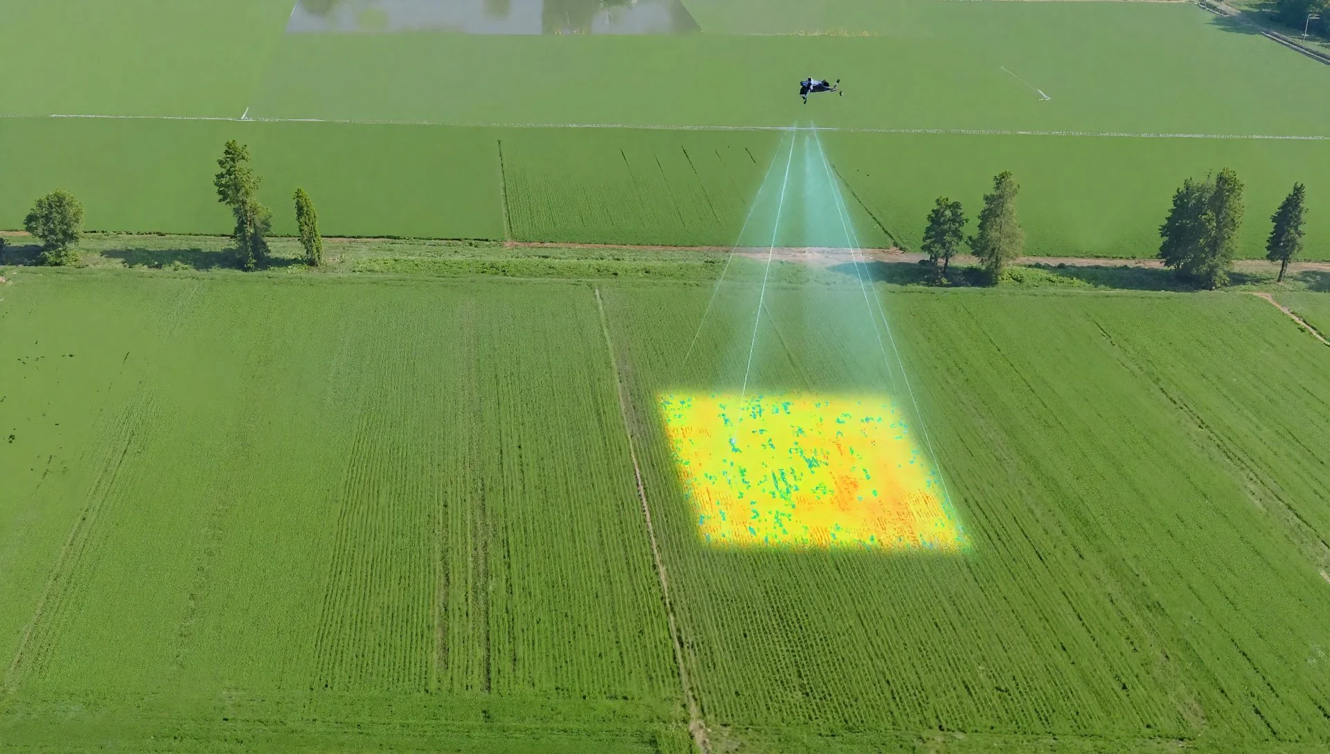
NDVI & NDRE
Our drones use specialized sensors to produce NDVI and NDRE maps, which measure plant health based on chlorophyll levels. This helps identify issues like nutrient deficiency, pest pressure, or disease before they’re visible to the naked eye. These maps allow farmers to make data-driven decisions, target inputs more effectively, and improve overall yields.
Our prices start from 4.5$ per acre. Request quote.
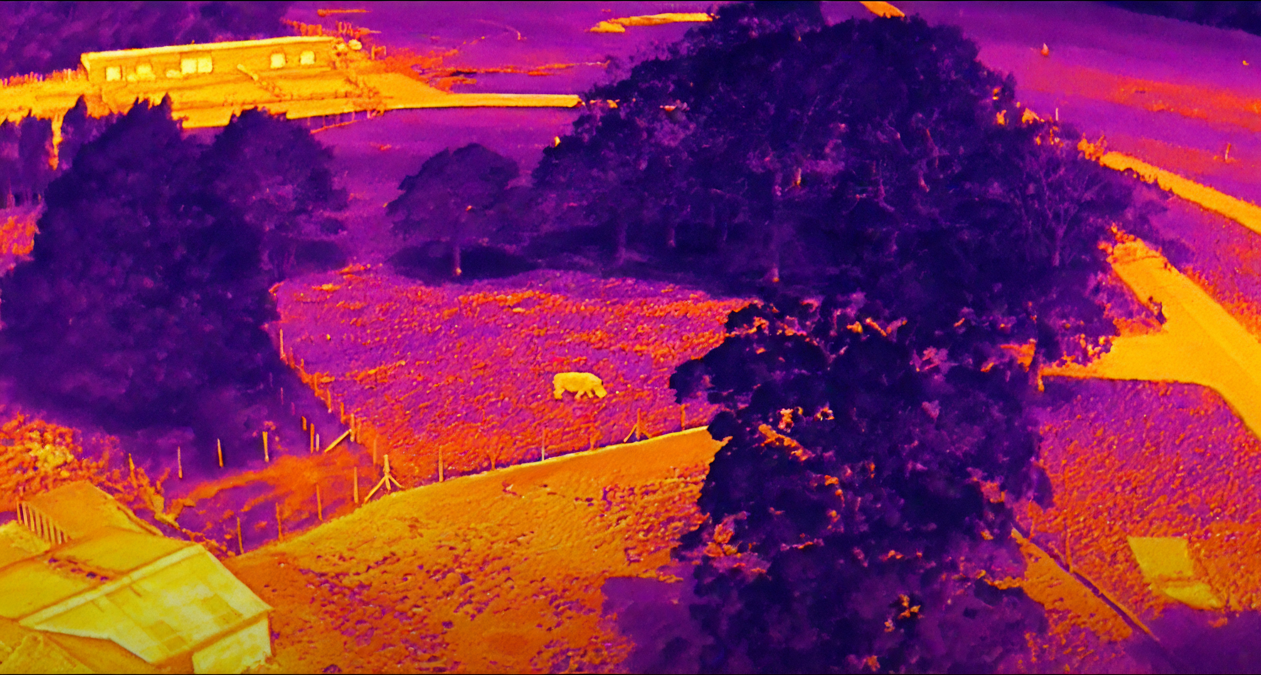
Thermal Imaging
Thermal drone scans reveal temperature variations across your fields. This makes it easy to identify irrigation leaks, clogged lines, over-watering, and drought stress. With this data, you can fine-tune irrigation schedules and reduce water waste.
Thermal imaging is also useful for livestock barns, greenhouses, and solar panels, identifying heat loss or malfunctioning systems quickly.
Request quote.
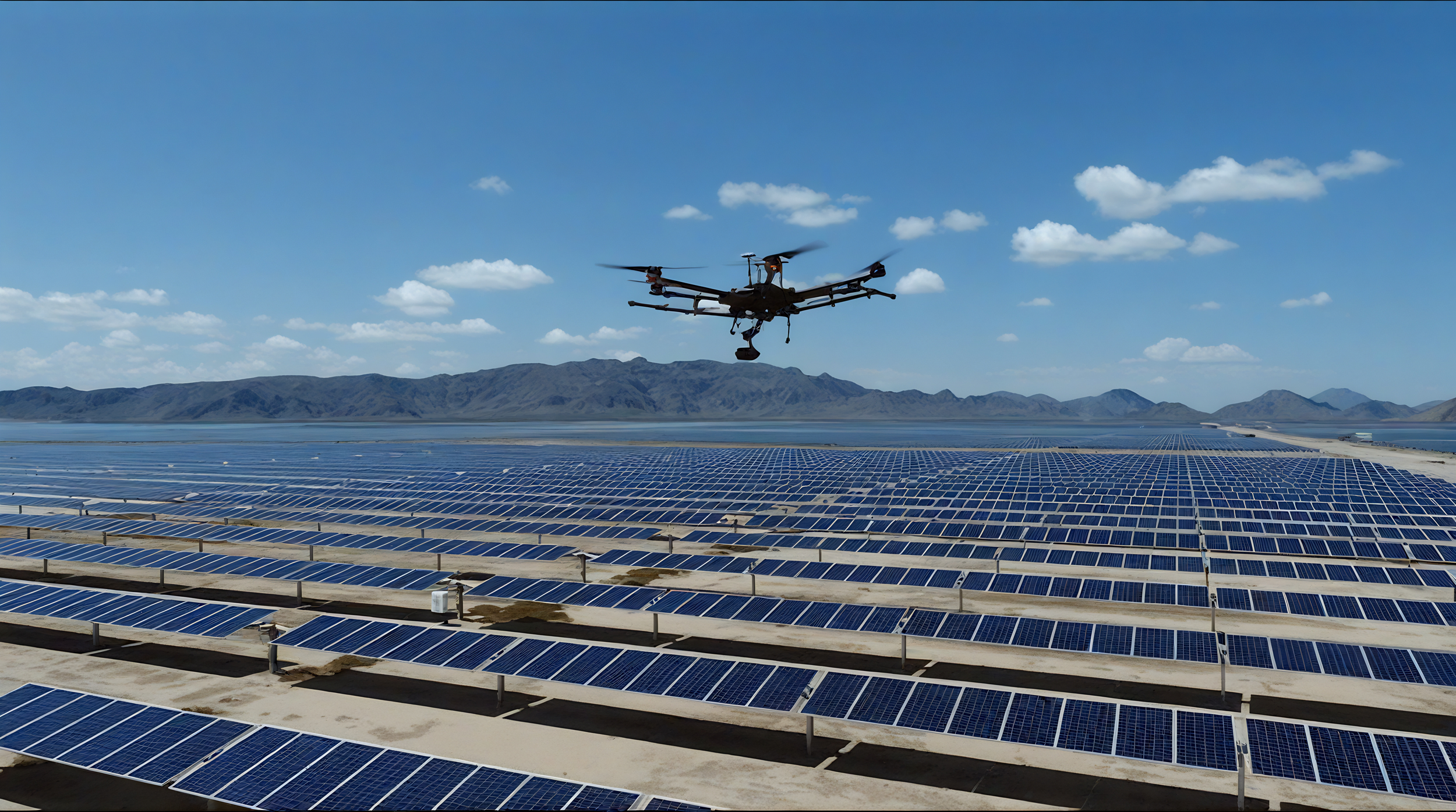
Roof & Solar Inspections
For property owners, contractors, and solar panels owners, drones make inspections safer and faster. High-resolution cameras and thermal sensors detect leaks, cracks without ladders, lifts, or scaffolding.
We deliver detailed photo and video reports that you can use for maintenance, insurance claims, or warranty coverage.
Request quote.
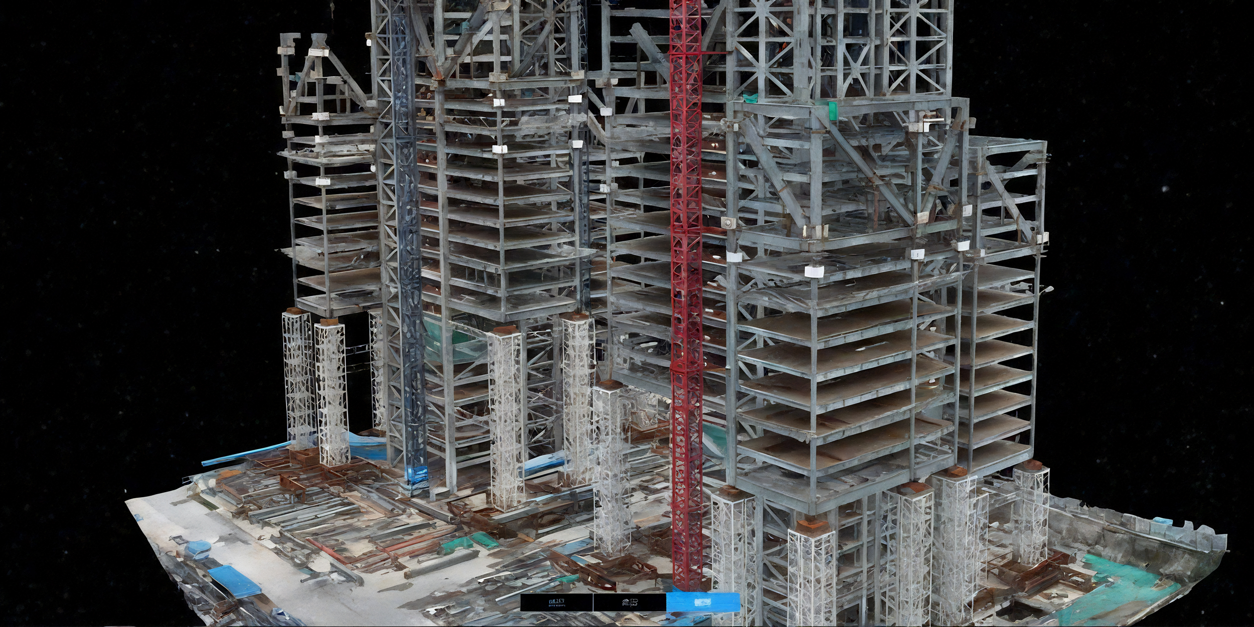
Construction Survey
Drones provide 3D terrain models, elevation maps, and volume calculations for construction sites, quarries, and development projects. Contractors save time and money compared to manual surveys, with centimeter-level accuracy.
You can track progress over time with repeat flights, keeping projects on schedule and on budget.
Request quote.
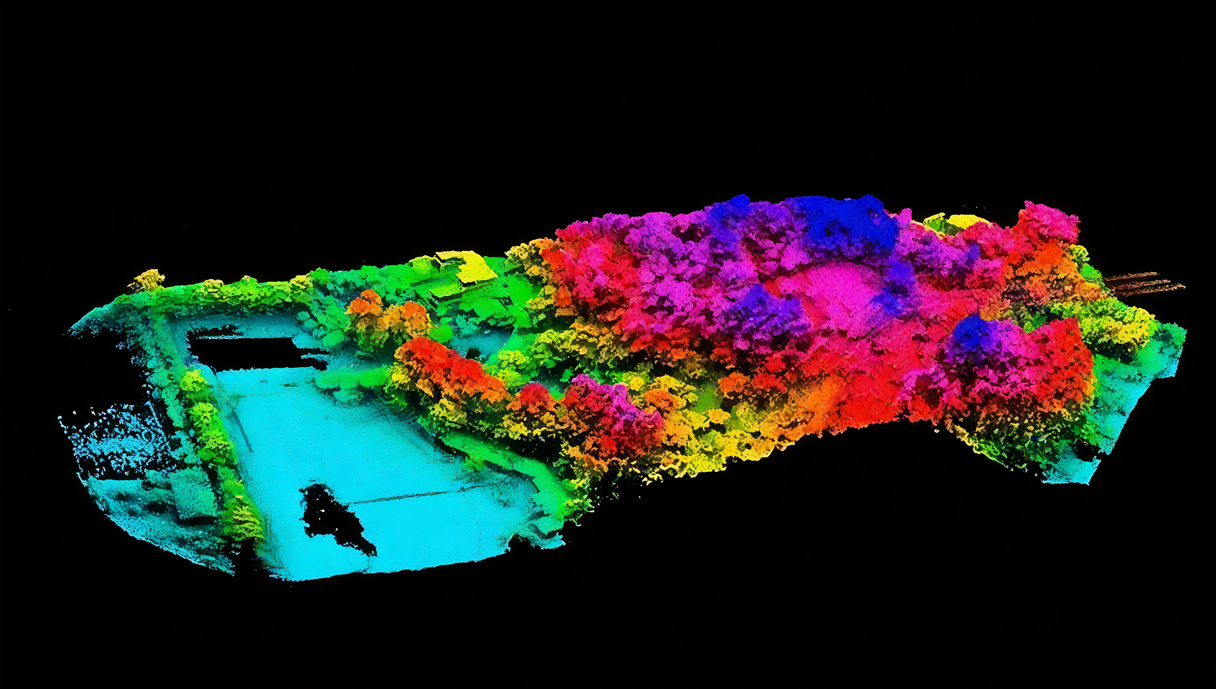
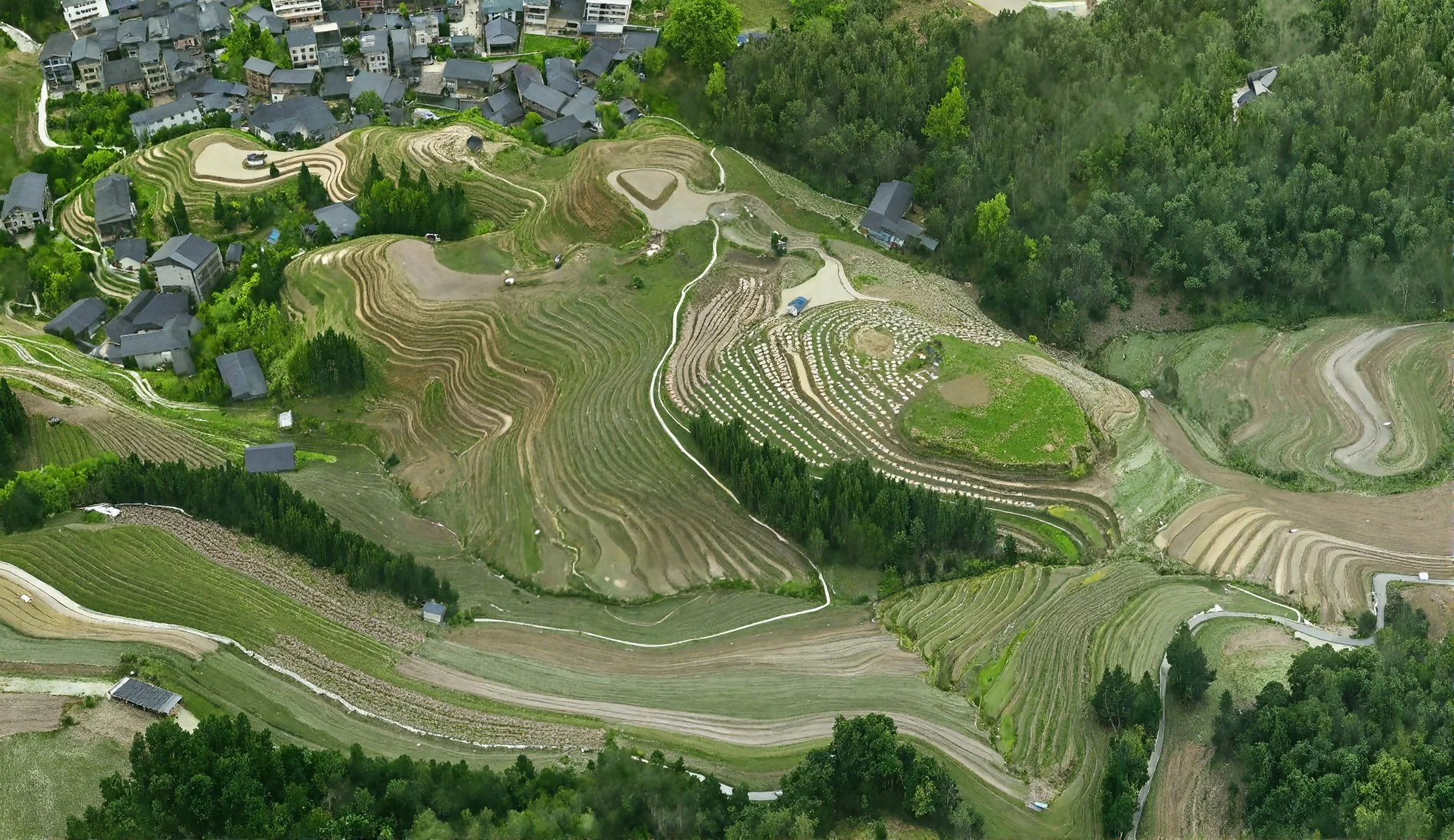
Land Survey
Using the DJI Matrice 350 RTK with L1 LiDAR, we deliver centimeter-level accuracy in a fraction of the time of traditional surveys. Our system captures millions of data points per second, producing detailed 3D terrain models, elevation maps, and colorized point clouds — even through vegetation.
Perfect for construction, mining, forestry, agriculture, and land development, our surveys provide fast, reliable data for planning, monitoring, and volume calculations.
Request quote.
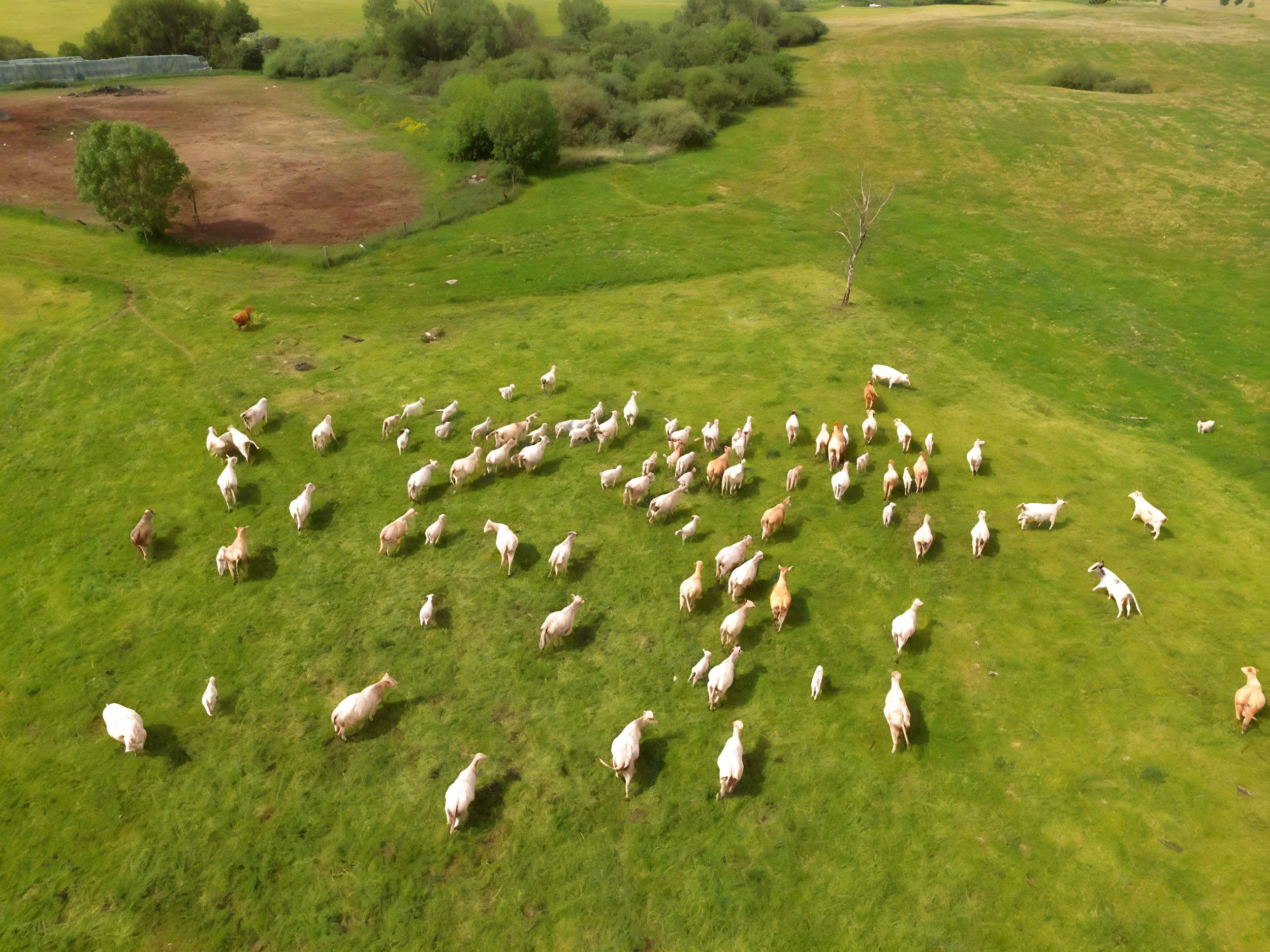
Livestock Monitoring
Managing livestock across large or rugged pastures can be time-consuming. Drones allow you to monitor herds, check water supplies, and even perform head counts quickly and safely.
This service reduces labor costs and increases animal welfare by ensuring timely checks without disturbing the herd.
Request quote.

Infrastructure Inspections
We inspect critical infrastructure such as bridges, towers, pipelines, power lines, and wind turbines. Equipped with high-resolution cameras, thermal sensors, and zoom capabilities, we capture detailed imagery that reveals cracks, corrosion, hot spots, and other issues.
We deliver precise, geo-referenced data that helps engineers and asset managers make informed maintenance decisions, reduce downtime, and improve safety.
Request quote.
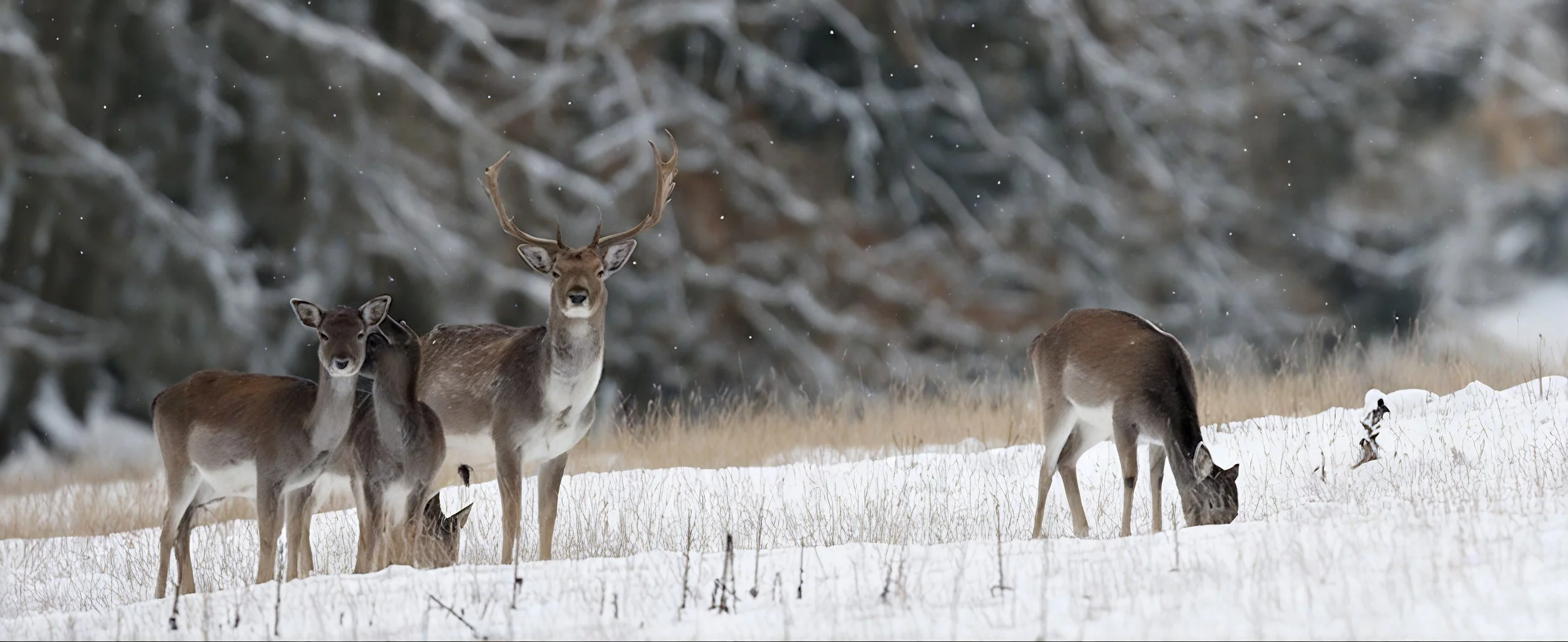
Environmental Monitoring
We can track animal populations, migration patterns, nesting sites, and habitat conditions — all without disturbing the environment.
We deliver precise, geo-referenced reports that support environmental studies, habitat protection, and regulatory requirements.
Request quote.

Have a project in mind that doesn’t fit into a standard category? Our drones can be adapted for countless applications — from research trials and industrial spraying to emergency response, photography, or specialized surveys.
If you can imagine it, chances are we can make it happen. Just let us know your idea, and our team will design a drone solution tailored to your needs.
Request quote.
Custom Drone Project